top of page


Scaled point clouds
By using the lidar scanner, it was possible to position the windows in relation to the fire escape stair. This helped when planning new...
Timothy Rowley
Sep 27, 20251 min read


Elevation scanning
Using the Stone X300, the scanner helped produce elevation to scale of a new conversion to be undertaken.
Timothy Rowley
Sep 27, 20251 min read


Lancaster bombers
Rowley Surveying Ltd has been chosen to measure the building that the Lancaster bomber in WW2 was built in. At 1.2 million square feet in...
Timothy Rowley
Dec 11, 20241 min read


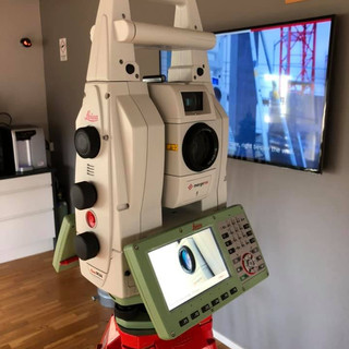
The equipment we use and deploy to our surveys
STONEX X300 is a 3D scanner designed to deliver effective results every day, on any project. Its ease of use, reliability, flexibility,...
Timothy Rowley
Nov 30, 20242 min read


Different imagery through CAD LiDAR
When using point cloud data to create elevations, there are many different aspects that the finished elevation can be shown as.
Timothy Rowley
Nov 30, 20241 min read


Elevations with the use of total station and lidar
After carrying out a survey of the roof area, the Lidar scanner was used to the rear. Combining both data sets helped produce the rear...
Timothy Rowley
Nov 27, 20241 min read


3D Lidar scan with CAD overlay
The 3D laser scanner was used to obtain a point cloud scan of the front elevation of the building. This was then traced over within CAD...
Timothy Rowley
Nov 10, 20241 min read


Boundary disputes requiring absolute accuracy
When the lidar and GNSS isn’t giving the absolute accuracy required when measuring boundaries for legal purposes. The TS16 is deployed.
Timothy Rowley
Oct 25, 20241 min read


O2 Ritz Manchester
Rowley Surveying Ltd was asked to provide elevational data and roof plans for the O2 Ritz venue located in Manchester. To speed up the...
Timothy Rowley
Oct 24, 20241 min read


One of the most famous icon's in Barnsley
Trying black and white scans from over 50m away
Timothy Rowley
Sep 28, 20241 min read


Visual scan and elevational data
Elevations can be displayed with the original colour scan as well as the CAD elevation to show the existing appearance of any building.
Timothy Rowley
Sep 21, 20241 min read


Determination of a boundary plan
The determination of a boundary plan must be compiled to LR guidelines and standards. The following shows the necessary information the...
Timothy Rowley
Sep 21, 20241 min read


LiDAR applications in surveying
Using the 3D scanner, we are now able to scan full elevations in half the time it took when using a total station. We can then take these...
Timothy Rowley
Sep 21, 20241 min read
LiDAR 3D Scanner
Having to measure elevations has now been made easier with the new 3D scanner we have added to our equipment list. Scanning 40,000 points...
Timothy Rowley
Sep 17, 20241 min read
bottom of page